South America

You can avoid the chaos below by flying across the city on Mi Teleréfico.

You can avoid the chaos below by flying across the city on Mi Teleréfico.

I knew that Bolivia’s capital, Nuestra Señora de la Paz, is the highest capital city in the world. But somehow I pictured a remote, sleepy Andean retreat. Instead we discovered a chaotic city of a million souls spilling improbably down the sides of a steep canyon.

On the map La Paz looks like a short hop from the shores of Lake Titicaca. But our bus took its time winding through the rugged mountains of the Central Andes. As in the Sacred Valley of Peru I was stunned by the drama of the landscape. The colors are so vivid — deep blue sky, bright green trees, and billowing snow-white clouds. As I contemplated the drama of the clouds a thought suddenly occurred to me: Perhaps they are so stunning simply because we are so much closer to them! Here we are rolling through the landscape at 12,000 feet. Planes fly at 30,000 feet, and they are way above the clouds. So we must be roughly halfway to them. No wonder they form such an integral part of the landscape.

A cemetery peeks out from the roadside, backed by those stunning Andean clouds

A cemetery peeks out from the roadside, backed by those stunning Andean clouds

I was wondering how we were going to get across this narrow stretch of Lake Titicaca to cross into La Paz. Most of us passengers took a little speedboat, as our bus boarded this primitive looking ferry. A few sleeping Bolivians were left in the bus the whole time.

I was wondering how we were going to get across this narrow stretch of Lake Titicaca to cross into La Paz. Most of us passengers took a little speedboat, as our bus boarded this primitive looking ferry. A few sleeping Bolivians were left in the bus the whole time.

The Spanish founded La Paz in 1548 in a narrow bowl in this canyon, surrounded by the high altiplano. As the city grew it climbed up the walls of the canyon and spilled out into vast suburbs in the altiplano. The result is a city that ranges in elevation from 10,500 ft. to 13,500 ft. Transportation is a nightmare of long, twisting, clogged streets — until the birth of Mi Teleréfico.

Inaugurated in 2014, this will be the world’s most extensive (and only) rapid transit network consisting primarily of aerial cable cars. Today three lines — red, yellow, and green — whisk passengers from station to station, rising and falling over steep Andean peaks in between. The cars leave every 11 seconds, so you virtually never wait. Then you fly above the density and traffic, enjoying stunning views all the while — all for less than 50 cents a ride. Heck, you’d pay $15 for a ride like this in some other city! Seven more lines are in the planning stages.

It's nice to fly above the twisted chaotic streets of La Paz in a sleek cable car

It’s nice to fly above the twisted chaotic streets of La Paz in a sleek cable car

Back down in the colorful streets of central La Paz

Back down in the colorful streets of central La Paz

Looking across the roof of Iglesia San Francisco in central La Paz

Looking across the roof of Iglesia San Francisco in central La Paz

In the bell tower of Iglesia San Francisco

In the bell tower of Iglesia San Francisco

We enjoyed the modern Bolivian art at the Museum of Contemporary Art, but it was especially cool just to wander through the halls of this 19th century mansion partly designed by Gustave Eiffel

We enjoyed the modern Bolivian art at the Museum of Contemporary Art, but it was especially cool just to wander through the halls of this 19th century mansion partly designed by Gustave Eiffel

Plaza Murillo at the heart of La Paz with the presidential palace to the left and the cathedral to the right

Plaza Murillo at the heart of La Paz with the presidential palace to the left and the cathedral to the right

The tomb of independence leader Antonio José de Sucre, where these guys aren't going to be messed with

The tomb of independence leader Antonio José de Sucre, where these guys aren’t going to be messed with

On our last night in La Paz we met up with old friends from Copacabana, Law and Meg (pictured here with Jim)

On our last night in La Paz we met up with old friends from Copacabana, Law and Meg

Happy traveloholics hiking across Isla del Sol in Lake Titicaca

Happy traveloholics hiking across Isla del Sol in Lake Titicaca

No, we didn’t hop over to Copacabana beach in Rio; Copacabana is the first town you pass through crossing the Bolivian border from Puno. Bolivia is the 46th country we’ve been in since leaving the States in May 2013, so we feel like we’re starting to make progress on this “seeing the world” thing. Overall, it’s Mark’s 91st country while I’m now at 88 countries though we have a tentative plan for me catching up later this year.

Law & Meg - with a little luck we'll meet up with them in a few days in La Paz

Law & Meg – with a little luck we’ll meet up with them in a few days in La Paz

Late afternoon view of Lake Titicaca from our hotel room

Late afternoon view of Lake Titicaca from our hotel room

It’s definitely something of a backpacker tourist city, an easy stop off between Puno and La Paz. The downside of backpacker world is that there was a real dearth of good restaurants. The upside is that you’re more likely to meet interesting people, and on a couple occasions we did so. One fun couple we met, Law & Meg, are veteran travelers and we had a great dinner one night comparing travel stories. Law – who’s spent part of his life as both a rock musician and an actor – said he’d never met anyone who’d been to more countries than his 81, and here he was with two people who’d beat him. Of course, we have a couple decades on him so he may well pass us up some day. And Meg? Well, like us she has no permanent home. She travels. And she claims to be in the Army Reserves though Mark & I weren’t absolutely certain she wasn’t Cameron Diaz; I might have to see the two of them in the same place at the same time to be certain. Fun night!

This was our third stop on Lake Titicaca and it was truly the highlight. Unlike Puno, the main part of the town here is right on the lake, and on a beautiful piece of it. We had the good fortune of brilliant blue skies which, combined with the thin air at 12,500 feet above sea level and the amazing blue waters of Titicaca, made for some amazing views. The water is just unbelievably blue and clear. And with the hills and Andes all around it’s a pretty amazing place.

In the town itself there isn’t a lot to do. Cerro Calvario (Calvary Hill) sits just northwest of the town and, at 13,010 feet makes a pleasant hike with great views of the city. The next day I decided to just take off on my own up the hills east of Copa; when I reached the end of the trail I just continued up to about 13,700 feet with a great view of the city and lake. It was about as quiet as you can imagine up there.

The view of Copacabana from Cerro Calvario

The view of Copacabana from Cerro Calvario

This was way, way above Copa, just me and some birds and a couple wandering cows

This was way, way above Copa, just me and some birds and a couple wandering cows

Part of the interesting thing is that over a couple weeks now that we’ve been high in the Andes you really can adjust to the thin air. A few years ago when we hiked the Inca Trail the highest pass we crossed was at about 14,000 feet and it damn near killed me; at this point those heights are challenging but not that difficult.

A street scene in Copacabana. Bolivia is a poor country - noticeably poorer than Peru - and you see it here in our first stop. Note the cool bowler hats the women wear; I'm sure there's a good story behind them.

A street scene in Copacabana. Bolivia is a poor country – noticeably poorer than Peru – and you see it here in our first stop. Note the cool bowler hats the women wear; I’m sure there’s a good story behind them.

The real highlight of Copa, though, was a day trip out to Isla del Sol, Island of the Sun, where Incan legend has it the sun itself was born. There are a few little villages on the island, but the highlight for us was the north-to-south trail that runs maybe eight miles along the spine of the island, affording the intrepid hiker with some pretty amazing views. It included an overly long two-hour boat ride both out and back, but the hike was more than worth it. Interestingly, Mark & I had both recently had some questions about our ability to keep hiking like this. He’d had some problem with his knee recently, and I had that ugly recurrence of a pinched nerve. In his case whatever was bothering his knee was gone, and in my case the miracle-working neurologist from Puno was, well, a miracle worker. I’m healed again, and an eight-mile hike up around 13,000 feet is pretty solid evidence. Yay!

If we had it to do again we’d probably have spent less time on Isla Suasi – it was lovely and relaxing but not as exciting – and left time to spend a night or two on Isla del Sol. We’ll keep that in mind the next time we come to Lake Titicaca. For now it’s on to La Paz, Bolivia’s capital city.

The boat ride out to Isla del Sol. We just couldn't believe how beautiful the sky and clouds and water were.

The boat ride out to Isla del Sol. We just couldn’t believe how beautiful the sky and clouds and water were.

That's Isla del Sol on the left. We were excited at the prospect of hiking across the top of it.

That’s Isla del Sol on the left. We were excited at the prospect of hiking across the top of it.

Near the start of the hike at the northern end of the island

Near the start of the hike at the northern end of the island

Greens, blues, white clouds … and some asses there, too!

Greens, blues, white clouds … and some asses there, too!

Mark - no knee pain

Mark – no knee pain

Jim - no back pain

Jim – no back pain

The trail wasn't too hard to follow

The trail wasn’t too hard to follow

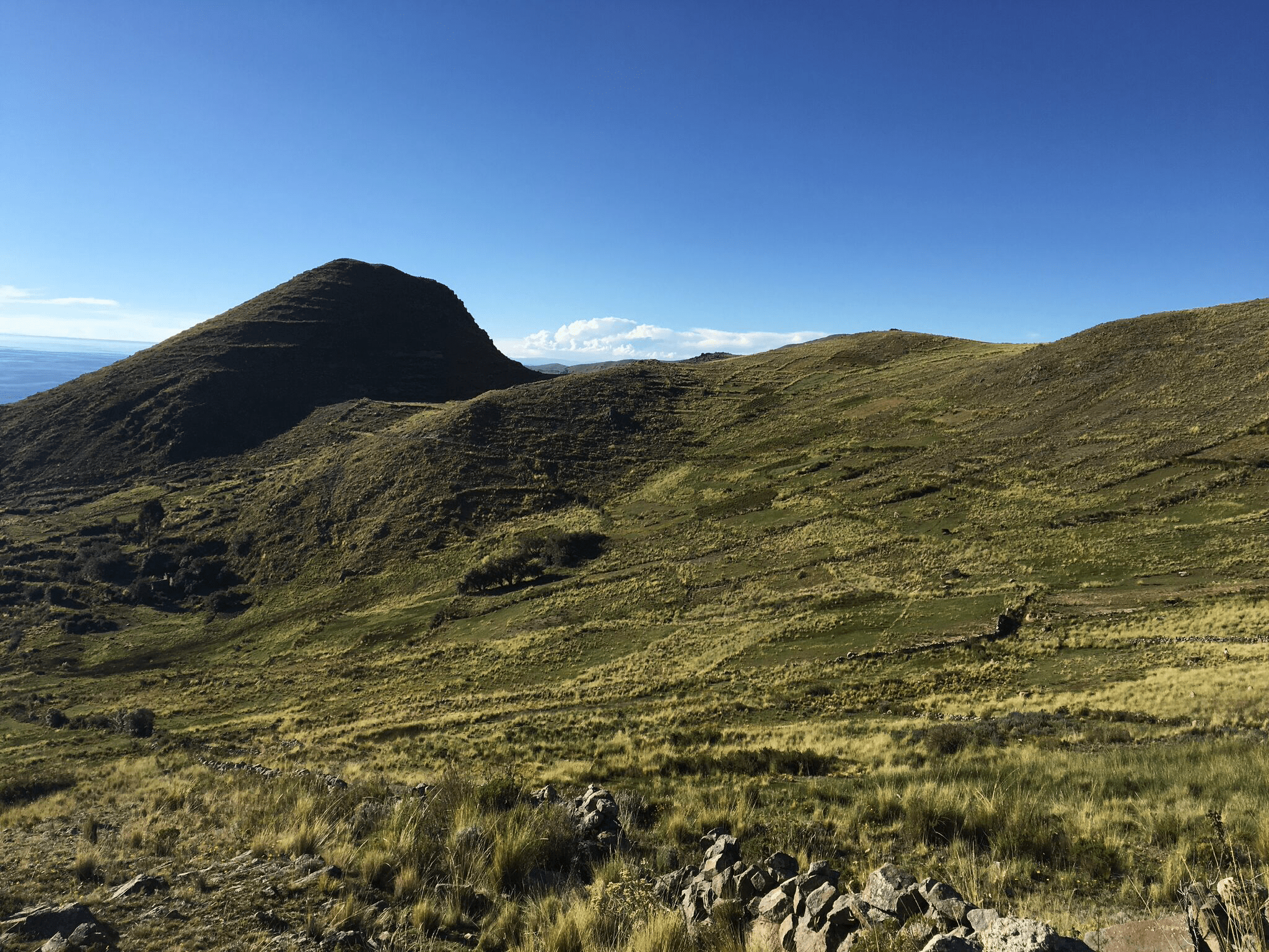
There was ancient Incan terracing all over the island

There was ancient Incan terracing all over the island

As you'd look across the lake to the mainland you could see snow-capped Andean peaks in the distance

As you’d look across the lake to the mainland you could see snow-capped Andean peaks in the distance

More Incan terraces

More Incan terraces

More Mark on the Incan-paved trail. To this day there are no vehicles on the island so this is how people get around.

More Mark on the Incan-paved trail. To this day there are no vehicles on the island so this is how people get around.

Does he look happy?

Does he look happy?

That's me nearing the high point of the journey

That’s me nearing the high point of the journey

As we neared the end of the hike we crossed this cute little church

As we neared the end of the hike we crossed this cute little church

Here we are on the mainland, en route to Isla Suasi, which can be seen behind us

Here we are on the mainland, en route to Isla Suasi, which can be seen behind us

OK, now we’ve made it to Lake Titicaca. You’d never know it from Puno, but besides having such a fun name Titicaca has a lot going for it besides just forming part of the border between Peru and Bolivia. For one thing, it’s huge, about 3,100 square miles in surface area (about one-third the size of Lake Erie, to give that some context), making it the 18th largest lake in the world by surface area. Measured by water volume, though, Titicaca is the 15th biggest lake and in fact has about twice as much volume as Lake Erie. So yeah, it’s big, and deep.

On the way to the island we drove overland and then took this zodiac maybe 10 minutes. On the way back we were on a much bigger boat traversing the length of the island.

On the way to the island we drove overland and then took this zodiac maybe 10 minutes. On the way back we were on a much bigger boat traversing the length of the island.

This could be one definition of "navigable." That's me down there starting my kayak trip around the island.

This could be one definition of “navigable.” That’s me down there starting my kayak trip around the island.

Our blissful "private" fireplace, perfect for listening to our own music and sipping scotch

Our blissful “private” fireplace, perfect for listening to our own music and sipping scotch

And it’s high, too. In fact at 12,500 feet above sea level it’s usually described as the highest navigable lake in the world. Now, “navigable” can mean a lot of things, but basically the 20 or so lakes that are higher are much smaller and shallower; if there are boats on them they’re just little fishing boats as opposed to commercial vehicles.

We wanted to get to know the lake a little and when we read on TripAdvisor about Isla Suasi, an island in the northwest corner of the lake that has just one hotel on it, we figured we’d hit the spot. One hotel and a couple of out buildings, some hiking trails, a couple small herds of alpacas and vicuñas, and that’s all. All on about 110 acres. Every so often I like to get really away from it all, and this certainly fits the bill.

To add to the isolation, the first and third days we were here we were the only guests. It’s kind of low season, though the weather has been just about perfect, sunny and low 60s. On our second day a group of 12 Italians and one Australian came, spent the evening, and left again late the next morning. Then Mark & I had it to ourselves again. Sweet!

What do you do out on an island like this? Not much. We both read a bunch, played some games on our iPads. Didn’t surf the web, since there was effectively no Internet out here. Sure as hell didn’t watch TV; I only noticed shortly before we left that there are no TVs. One night we were sitting in a public space in front of a beautiful fireplace and realized again we were the only guests in the hotel. So we got our portable stereo speakers, put them on top of the fireplace, and listened to fun music while sipping scotch and rum. That’s a good life!

Mostly we just enjoyed the quiet and beauty. We were surprised how Mediterranean it looks: the gorgeous flowers, the brilliant blue water, the sky and the clouds. There was an easy 15-minute hike up to the high point on the island where you were supposed to watch the sunset, but by evening every day it had clouded over. No problem; we still got to go out and watch the alpacas and vicuñas go about their business.

I was ambitious enough to go out a couple times on their kayaks, once just exploring a bit and then later circumnavigating the island. All beautiful. And then there was the big challenge: do you swim? At 12,500 feet the water is pretty cold, but somehow I couldn’t not swim so after my second kayak trip I went in for maybe five, maybe even 10 minutes. The water is beautifully clear but definitely cold. I grew up right near Lake Superior and I won’t say Titicaca was colder, but it was on par. I wonder if or when I’ll ever swim at a higher altitude.

Lunch - typically trout from the lake - was served outdoors with grand views of the gardens and lake far below

Lunch – typically trout from the lake – was served outdoors with grand views of the gardens and lake far below

Just another random view of the lake from our hotel's gardens

Just another random view of the lake from our hotel’s gardens

The last part of our Isla Suasi journey was the three-hour boat ride back. It was a pretty nice affair; a comfortable boat with just the two of us, the driver, and a guide. No pretense of any safety demonstration or expectation that you’ll wear a life jacket, even when you’re up on top of the boat for the views and the sun. On the way back to Puno we stopped at Isla Taquile, an island with strong old traditions, beautiful handicrafts, and terraced fields dating back to the Incas. Of course we don’t buy handicrafts (or anything else except soap and toothpaste, which they weren’t selling), but it was still fun to learn a little about the people and see their remarkably isolated and unique lifestyles. We’d have loved to have hiked around the island, but that’s not the way these arranged tours work.

Mark with one of the old guys on Isla Taquile. The men here, our guide pointed out, knit their own hats as well as stuff for their wives.

Mark with one of the old guys on Isla Taquile. The men here, our guide pointed out, knit their own hats as well as stuff for their wives.

And then we stopped one more time at the floating islands near Puno. This experience was a little better than the first one since our guide could explain things to us a little more clearly. She explained how of course people in such a small setting and with such daunting physical challenges – building and maintaining floating islands out of reeds – have to work together. But what happens if people don’t work together? I mean, not everyone has such a cooperative bent, right?

One of the floating islands

One of the floating islands

“Well,” she explained pointing at two houses close together on one of these tiny islands. “Imagine if the people in this house can’t get along with the people in that house. First, they would just turn their house in another direction so they don’t have to see the people they don’t like. But if things get worse, if say one family won’t participate in the community projects that need to be done, or if a family is just too disruptive, the rest of the community has a final resort. They just saw off the part of the island the offending family lives on and shove them away. ‘There, now you’re your own island and you have to take care of it yourself.'”

Sounds like a pretty great way to deal with unruly neighbors, eh?

So that’s pretty much the end of Peru for us. After spending a night back in Puno, we’ll take a bus on into Bolivia. It was a great month exploring southern Peru!

Our first afternoon on the island we hiked up to the highest point on the western edge to see the sunset. Alas, there was no sunset to see due to the clouds, but we did get this nice picture of Mark and our guide Videz.

Our first afternoon on the island we hiked up to the highest point on the western edge to see the sunset. Alas, there was no sunset to see due to the clouds, but we did get this nice picture of Mark and our guide Videz.

There were small herds of both alpacas and vicuñas on the island. This was my first glimpse of the vicuña, an animal I found sleek, elegant, and gorgeous.

There were small herds of both alpacas and vicuñas on the island. This was my first glimpse of the vicuña, an animal I found sleek, elegant, and gorgeous.

An alpaca posing for us

An alpaca posing for us

More vicuñas

More vicuñas

And more alpacas

And more alpacas

That rock down there was one of my favorite isolated reading spots

That rock down there was one of my favorite isolated reading spots

Passion fruit growing in a pergola right outside the hotel

Passion fruit growing in a pergola right outside the hotel

My selfie while kayaking around Isla Suasi

My selfie while kayaking around Isla Suasi

All our meals were at the hotel's restaurant. The food was mostly good, but this trout tartare was outstanding; we probably had it three or four different times.

All our meals were at the hotel’s restaurant. The food was mostly good, but this trout tartare was outstanding; we probably had it three or four different times.

A view of Lake Titicaca from the top of our boat. It's a big, beautiful lake.

A view of Lake Titicaca from the top of our boat. It’s a big, beautiful lake.

One of the many little floating islands. You can see over on the right side smallish blocks of … something. That's the root stock that floats in the lake, on which they pile layer after layer of reeds. And it's the root stock that they would saw off if they didn't like someone on their island.

One of the many little floating islands. You can see over on the right side smallish blocks of … something. That’s the root stock that floats in the lake, on which they pile layer after layer of reeds. And it’s the root stock that they would saw off if they didn’t like someone on their island.

Mark found a kitty on the island. According to Wikipedia, they keep cats to control the rat population.

Mark found a kitty on the island. According to Wikipedia, they keep cats to control the rat population.

And how long do you think it took for Mark to make friends with said cat?

And how long do you think it took for Mark to make friends with said cat?

They make everything with reeds, including these "Mercedes" taxis for getting around

They make everything with reeds, including these “Mercedes” taxis for getting around

There are easier ways of moving these big boats around than rowing them. Here you see a little motor boat providing the propulsion.

There are easier ways of moving these big boats around than rowing them. Here you see a little motor boat providing the propulsion.